filter-iconSzűrő
close-icon
Médiatípus
Licenc típus
Orientáció
Stílus
Kizárás

Karib-szigetek stock-vektorok és illusztrációk

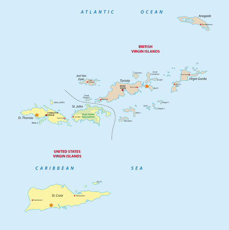
Virgin islands map
Virgin islands map123RF Prémium
VektorokSimilar Images
High detail map of central america with a 3d globe centered on these countries Stock fotó
High detail map of central america with a 3d globe centered on these countries
VektorokSimilar Images
Guadeloupe dominica martinique political map with capitals basse terre roseau and fort de france caribbean islands parts of lesser antilles gray illustration over white english labeling vector Stock fotó
Guadeloupe dominica martinique political map with capitals basse terre roseau and fort de france caribbean islands parts of lesser antilles gray illustration over white english labeling vector
VektorokSimilar Images
British virgin islands map vector illustration global economy famous country caribbean latin america america Vektoros grafika
British virgin islands map vector illustration global economy famous country caribbean latin america america123RF Prémium
VektorokSimilar Images
Saint barthelemy political map with capital gustavia also called st barts or st barths is an overseas collectivity of france english labeling and scaling illustration
VektorokSimilar Images
Map of providenciales with beautiful gradients authentic set of providenciales maps amusing vector illustration
VektorokSimilar Images
Vector composition of fire caribbean islands map and blue round distress uppsala seal stamp fiery caribbean islands map mosaic of fire items vector composition for guard services Stock fotó
Vector composition of fire caribbean islands map and blue round distress uppsala seal stamp fiery caribbean islands map mosaic of fire items vector composition for guard services
VektorokSimilar Images
Caribbean islands and central america map individual states and islands and city whit names blue background vector
Caribbean islands and central america map individual states and islands and city whit names blue background vector123RF Prémium
VektorokSimilar Images
Turks and caicos islands logo sign travel rubber stamp with the name and map of island vector illustration can be used as insignia logotype label sticker or badge
VektorokSimilar Images
Production caribbean islands map and blue kosher shop scratched watermark colored vector caribbean islands map mosaic of production elements blue round kosher shop seal
VektorokSimilar Images
Map of little cayman island â cayman islands contains geography outlines for land mass water major roads and minor roads Stock fotó
Map of little cayman island â cayman islands contains geography outlines for land mass water major roads and minor roads
VektorokSimilar Images
Turks and caicos islands logo sign with the map of island and colored stripes vector illustration can be used as insignia logotype label sticker or badge of the turks and caicos islands Logó
Turks and caicos islands logo sign with the map of island and colored stripes vector illustration can be used as insignia logotype label sticker or badge of the turks and caicos islands123RF Prémium
VektorokSimilar Images
Lesser antilles outline map with flag dominica
Lesser antilles outline map with flag dominica123RF Prémium
VektorokSimilar Images
Caribbean islands central america map state names separate states blackboard chalkboard vector
VektorokSimilar Images
Windward islands political map islands of the lesser antilles south of the leeward islands in the caribbean sea from dominica martinique saint lucia saint vincent and the grenadines to grenada
Windward islands political map islands of the lesser antilles south of the leeward islands in the caribbean sea from dominica martinique saint lucia saint vincent and the grenadines to grenada123RF Prémium
VektorokSimilar Images
Vector map saint john us virgin islands
Vector map saint john us virgin islands123RF Prémium
VektorokSimilar Images
Antigua island in the lesser antilles gray political map one of the leeward islands in the caribbean region and most populous island of the country of antigua and barbuda Stock fotó
Antigua island in the lesser antilles gray political map one of the leeward islands in the caribbean region and most populous island of the country of antigua and barbuda123RF Prémium
VektorokSimilar Images
Virgin islands political map island group between caribbean sea and atlantic ocean part of lesser antilles and leeward islands
VektorokSimilar Images
Curacao political map with capital willemstad and important cities english labeling and scaling illustration Stock fotó
Curacao political map with capital willemstad and important cities english labeling and scaling illustration
VektorokSimilar Images
Cayman islands map flag and text illustration on world map Stock fotó
Cayman islands map flag and text illustration on world map
VektorokSimilar Images
Map of british virgin islands in the old style brown graphics in retro fantasy style Stock fotó
Map of british virgin islands in the old style brown graphics in retro fantasy style123RF Prémium
VektorokSimilar Images
Central america and caribbean islands map classic color individual states and city whit names vector
Central america and caribbean islands map classic color individual states and city whit names vector123RF Prémium
VektorokSimilar Images
Caribbean islands map individual island with names infographics and icons vector Stock fotó
Caribbean islands map individual island with names infographics and icons vector123RF Prémium
VektorokSimilar Images
Caribbean islands map individual islands and names design glass card 3d vector Stock fotó
Caribbean islands map individual islands and names design glass card 3d vector123RF Prémium
VektorokSimilar Images
Middle america political map with capitals and borders mid latitudes of the americas region mexico central america the caribbean and northern south america illustration english labeling vector
VektorokSimilar Images
Map of the british virgin islands drawn with high detail and accuracy Stock fotó
Map of the british virgin islands drawn with high detail and accuracy
VektorokSimilar Images
Saint lucia political map with capital castries and important places english labeling and scaling illustration
VektorokSimilar Images
Map of east caicos island â turks and caicos islands contains geography outlines for land mass water major roads and minor roads
VektorokSimilar Images
Vector map of the three sss islands netherlands antilles
Vector map of the three sss islands netherlands antilles123RF Prémium
VektorokSimilar Images
Salt cay turks islands polygonal map mosaic style island interesting low poly style modern design salt cay turks islands polygonal map for infographics or presentation
VektorokSimilar Images
Turks and caicos islands lock down sign yellow island pandemic danger icon vector illustration
Turks and caicos islands lock down sign yellow island pandemic danger icon vector illustration123RF Prémium
VektorokSimilar Images
Salt cay turks islands closed virus danger sign lock down island icon black striped border around map with virus spread concept vector illustration
Salt cay turks islands closed virus danger sign lock down island icon black striped border around map with virus spread concept vector illustration123RF Prémium
VektorokSimilar Images
Trinidad and tobago political map with capital port of spain twin island country in the windward islands and lesser antilles english labeling and scaling illustration
VektorokSimilar Images
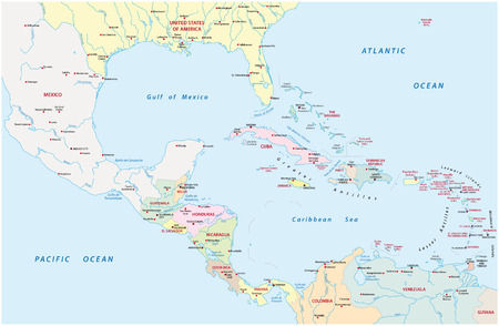
Administrative map of central america and the caribbean countries
Administrative map of central america and the caribbean countries123RF Prémium
VektorokSimilar Images
Wire frame irregular mesh caribbean islands map abstract lines are combined into caribbean islands map wire carcass flat net in vector format
Wire frame irregular mesh caribbean islands map abstract lines are combined into caribbean islands map wire carcass flat net in vector format123RF Prémium
VektorokSimilar Images
Vector polygonal virgin islands map map of the island with network mesh background virgin islands illustration in technology internet network telecommunication concept style
Vector polygonal virgin islands map map of the island with network mesh background virgin islands illustration in technology internet network telecommunication concept style123RF Prémium
VektorokSimilar Images
Greater antilles political map vector illustration
VektorokSimilar Images
Saint vincent and the grenadines political map with capital kingstown island country in the lesser antilles island arc english labeling and scaling illustration
VektorokSimilar Images
Low poly map of salt cay turks islands geometric illustration of the island salt cay turks islands polygonal map technology internet network concept vector illustration
Low poly map of salt cay turks islands geometric illustration of the island salt cay turks islands polygonal map technology internet network concept vector illustration123RF Prémium
VektorokSimilar Images
Lesser antilles outline map with british virgin islands
Lesser antilles outline map with british virgin islands123RF Prémium
VektorokSimilar Images
Saint lucia road and beach vector map
Saint lucia road and beach vector map123RF Prémium
VektorokSimilar Images
Vector map of the honduran caribbean island of utila honduras
Vector map of the honduran caribbean island of utila honduras123RF Prémium
VektorokSimilar Images
Vector mosaic and solid map of caribbean islands map of caribbean islands vector mosaic for clean water ads map of caribbean islands is formed with blue clear water tears Stock fotó
Vector mosaic and solid map of caribbean islands map of caribbean islands vector mosaic for clean water ads map of caribbean islands is formed with blue clear water tears123RF Prémium
VektorokSimilar Images
Cuba political map with capital havana national borders most important cities and rivers english labeling and scaling illustration Stock fotó
Cuba political map with capital havana national borders most important cities and rivers english labeling and scaling illustration
VektorokSimilar Images
Curacao gray political map island in the leeward antilles in the caribbean sea with capital willemstad lesser antilles island country and part of the abc islands off the coast of venezuela vector
Curacao gray political map island in the leeward antilles in the caribbean sea with capital willemstad lesser antilles island country and part of the abc islands off the coast of venezuela vector123RF Prémium
VektorokSimilar Images
Turks and caicos islands stamp travel rubber stamp with the name and map of island vector illustration can be used as insignia logotype label sticker or badge of the turks and caicos islands
Turks and caicos islands stamp travel rubber stamp with the name and map of island vector illustration can be used as insignia logotype label sticker or badge of the turks and caicos islands123RF Prémium
VektorokSimilar Images
Montserrat capital plymouth political map with important places and rivers english labeling and scaling illustration
VektorokSimilar Images
Street map of the caribbean island of anguilla united kingdom
Street map of the caribbean island of anguilla united kingdom123RF Prémium
VektorokSimilar Images
Greater antilles political map caribbean islands cuba jamaica haiti dominican republic puerto rico cayman islands the bahamas turks and caicos islands illustration english labeling vector
VektorokSimilar Images
Turks and caicos islands badge round design of island with triangular mesh map and radial rays
Turks and caicos islands badge round design of island with triangular mesh map and radial rays123RF Prémium
VektorokSimilar Images
Romantic vacation on the beach at sunset illustration silhouette overwater bungalows of a luxury resort a view on the otemanu bora bora french
VektorokSimilar Images
Aruba political map with capital oranjestad and important cities english labeling and scaling illustration
VektorokSimilar Images
Set of 3d isometric people with flags of caribbean countries standard bearers infographic honduras guatemala el salvador cayman islands nicaragua belize
VektorokSimilar Images
Turks and caicos islands logo map of turks and caicos islands with island name and flag amazing vector illustration
Turks and caicos islands logo map of turks and caicos islands with island name and flag amazing vector illustration123RF Prémium
VektorokSimilar Images
Saint kitts and nevis vector road map
Saint kitts and nevis vector road map123RF Prémium
VektorokSimilar Images
Low poly caribbean islands map polygonal caribbean islands map vector constructed from randomized triangles triangulated caribbean islands map polygonal model for political posters
Low poly caribbean islands map polygonal caribbean islands map vector constructed from randomized triangles triangulated caribbean islands map polygonal model for political posters123RF Prémium
VektorokSimilar Images
Vector polygonal salt cay turks islands map map of the island with network mesh background salt cay turks islands illustration in technology internet network telecommunication concept style Stock fotó
Vector polygonal salt cay turks islands map map of the island with network mesh background salt cay turks islands illustration in technology internet network telecommunication concept style123RF Prémium
VektorokSimilar Images
Map of caribbean islands vector mosaic and clean water grunge stamp map of caribbean islands created with blue water tears seal with grunge rubber texture for clear drinking water Stock fotó
Map of caribbean islands vector mosaic and clean water grunge stamp map of caribbean islands created with blue water tears seal with grunge rubber texture for clear drinking water
VektorokSimilar Images
Virgin islands low poly sunburst set design of island in geometric polygonal style vector illustration Stock fotó
Virgin islands low poly sunburst set design of island in geometric polygonal style vector illustration123RF Prémium
VektorokSimilar Images
Turks and caicos islands closed virus danger sign lock down island icon black striped border around map with virus spread concept vector illustration
Turks and caicos islands closed virus danger sign lock down island icon black striped border around map with virus spread concept vector illustration123RF Prémium
VektorokSimilar Images
Big corn island republic of nicaragua cenrtal america caribbean islands map vector illustration scribble sketch corn map Stock fotó
Big corn island republic of nicaragua cenrtal america caribbean islands map vector illustration scribble sketch corn map123RF Prémium
VektorokSimilar Images
British virgin islands map with flag Vektoros grafika
British virgin islands map with flag123RF Prémium
VektorokSimilar Images
Cayman islands blue low poly map with capital george town versions with flag black and outline vector illustration
VektorokSimilar Images
Passport stamp of the windward islands of the caribbean
Passport stamp of the windward islands of the caribbean123RF Prémium
VektorokSimilar Images
Cayman islands map flag glass card paper 3d vector grand cayman
VektorokSimilar Images
Map of the cayman islands islands drawn with high detail and accuracy
VektorokSimilar Images
Santorini aegean sea islands flat cartoon style attraction
Santorini aegean sea islands flat cartoon style attraction123RF Prémium
VektorokSimilar Images
Coronavirus in salt cay turks islands sign round badge with shape of salt cay turks islands yellow island lock down emblem with title and virus signs vector illustration Stock fotó
Coronavirus in salt cay turks islands sign round badge with shape of salt cay turks islands yellow island lock down emblem with title and virus signs vector illustration123RF Prémium
VektorokSimilar Images
Caribbean islands central america map with individual states separated infographics with icons vector Stock fotó
Caribbean islands central america map with individual states separated infographics with icons vector
VektorokSimilar Images
Salt cay turks islands stamp travel red rubber stamp with the map of island vector illustration can be used as insignia logotype label sticker or badge of the salt cay turks islands Stock fotó
Salt cay turks islands stamp travel red rubber stamp with the map of island vector illustration can be used as insignia logotype label sticker or badge of the salt cay turks islands123RF Prémium
VektorokSimilar Images
British spanish and united states virgin islands political map archipelago in the caribbean sea british overseas territory and unincorporated territories of the united states illustration vector Stock fotó
British spanish and united states virgin islands political map archipelago in the caribbean sea british overseas territory and unincorporated territories of the united states illustration vector123RF Prémium
VektorokSimilar Images
Wpa poster art of trunk bay beach located within virgin islands national park on the island of st john in the caribbean sea done in works project administration style or federal art project style
Wpa poster art of trunk bay beach located within virgin islands national park on the island of st john in the caribbean sea done in works project administration style or federal art project style123RF Prémium
VektorokSimilar Images
Caribbean islands and central america map states and islands and capitals with names old paper background vector
Caribbean islands and central america map states and islands and capitals with names old paper background vector123RF Prémium
VektorokSimilar Images
Leeward antilles gray political map caribbean island chain from aruba curacao and bonaire to la tortuga and margarita island southerly islands of the lesser antilles north the venezuelan coast Stock fotó
Leeward antilles gray political map caribbean island chain from aruba curacao and bonaire to la tortuga and margarita island southerly islands of the lesser antilles north the venezuelan coast123RF Prémium
VektorokSimilar Images
Central america and caribbean islands map infographics flat design colors snow white with names of individual states and island vector
Central america and caribbean islands map infographics flat design colors snow white with names of individual states and island vector123RF Prémium
VektorokSimilar Images
Virgin islands low poly logo colorful gradient travel logo of the island in geometric style multicolored polygonal virgin islands rounded sign with map for your infographics
VektorokSimilar Images
Salt cay turks islands dotted map set map of salt cay turks islands in dotted style borders of the island filled with beautiful smooth gradient circles powerful vector illustration
Salt cay turks islands dotted map set map of salt cay turks islands in dotted style borders of the island filled with beautiful smooth gradient circles powerful vector illustration123RF Prémium
VektorokSimilar Images
Barbados political map with capital bridgetown with important cities places and rivers english labeling and scaling illustration
VektorokSimilar Images
Turks and caicos islands stamp travel red rubber stamp with the map of island vector illustration can be used as insignia logotype label sticker or badge of the turks and caicos islands
Turks and caicos islands stamp travel red rubber stamp with the map of island vector illustration can be used as insignia logotype label sticker or badge of the turks and caicos islands123RF Prémium
VektorokSimilar Images
Cayman islands map vector illustration global economy famous country caribbean latin america america
Cayman islands map vector illustration global economy famous country caribbean latin america america123RF Prémium
VektorokSimilar Images
Summer landscape of the tropical island in the ocean with palm trees flat
Summer landscape of the tropical island in the ocean with palm trees flat123RF Prémium
VektorokSimilar Images
Martinique political map with capital fortdefrance and important places overseas region of france in the lesser antilles region of the caribbean sea english labeling and scaling illustration
VektorokSimilar Images
Lesser antilles outline map british virgin islands with flag Vektoros grafika
Lesser antilles outline map british virgin islands with flag123RF Prémium
VektorokSimilar Images
Salt cay turks islands colorful low poly island shape multicolor geometric triangles modern trendy design vector illustration
Salt cay turks islands colorful low poly island shape multicolor geometric triangles modern trendy design vector illustration123RF Prémium
VektorokSimilar Images
Caribbean islands map island with names blue white card paper 3d vector
Caribbean islands map island with names blue white card paper 3d vector123RF Prémium
VektorokSimilar Images
Turks and caicos islands polygonal island map mosaic style maps collection bright abstract tessellation geometric low poly modern design
VektorokSimilar Images
Island map us british caribbean ocean uk territory united kingdom road town america british virgin islands atlantic ocean leeward islands cartography oversea charlotte amalie virgin islands country tourism sea saint croix united stat
Island map us british caribbean ocean uk territory united kingdom road town america british virgin islands atlantic ocean leeward islands cartography oversea charlotte amalie virgin islands country tourism sea saint croix united stat123RF Prémium
VektorokSimilar Images
Caribbean islands and central america map individual regions with names infographics and icons vector
Caribbean islands and central america map individual regions with names infographics and icons vector123RF Prémium
VektorokSimilar Images
Detailed map of u s virgin islands and capital city charlotte amalie with flag on black background
VektorokSimilar Images
Guadeloupe islands highly detailed physical map Vektoros grafika
Guadeloupe islands highly detailed physical map123RF Prémium
VektorokSimilar Images
Turks and caicos islands map blank vector map of the island borders of turks and caicos islands for your infographic vector illustration
VektorokSimilar Images
Hispaniola and surroundings political map caribbean island divided into haiti and dominican republic part of greater antilles next to cuba the bahamas puerto rico and turks
Hispaniola and surroundings political map caribbean island divided into haiti and dominican republic part of greater antilles next to cuba the bahamas puerto rico and turks123RF Prémium
VektorokSimilar Images
Santorini aegean sea islands flat cartoon style attraction vector
Santorini aegean sea islands flat cartoon style attraction vector123RF Prémium
VektorokSimilar Images
Cayman islands
Cayman islands
VektorokSimilar Images
Map of west caicos island â turks and caicos islands contains geography outlines for land mass water major roads and minor roads
VektorokSimilar Images
Vector map of caribbean islands mosaic of circle elements and red watermark seal stamp hole circle map of caribbean islands collage composed with circles in various sizes and red color tints
Vector map of caribbean islands mosaic of circle elements and red watermark seal stamp hole circle map of caribbean islands collage composed with circles in various sizes and red color tints123RF Prémium
VektorokSimilar Images
Caribe beach Stock fotó
Caribe beach
VektorokSimilar Images
Infographics central america and caribbean islands map flat design colors states and island with names blue background with orange points vector
Infographics central america and caribbean islands map flat design colors states and island with names blue background with orange points vector123RF Prémium
VektorokSimilar Images
Vector street map of the caribbean island of saba Vektoros grafika
Vector street map of the caribbean island of saba123RF Prémium
VektorokSimilar Images
Map of cayman islands with regions coat of arms and location on world map
Map of cayman islands with regions coat of arms and location on world map123RF Prémium
VektorokSimilar Images